|
A web
site for the village of Hartshorne,
Derbyshire, United Kingdom. |
|
|
|
|
| Menu | |
|
|
|
| Local area | |
| News & What's on | |
| Search | |
|
Quick
search Advanced search |
|
| Guest Book | |
| Business | |
| List/Adverts |
|
| Web site | |
|
Foremark Reservoir Foremark Reservoir is 230 acres of water situated in the heart of the National Forest between Derby and Burton-on-Trent. Treasured mainly for its wildlife habitats, the Reservoir is also a centre for those who love the outdoors, whether its participating in watersports on the water, or enjoying a cycling or walking trail around the Reservoir. The tail end of the reservoir known as Cavers Rocks is a Site of Special Scientific Interest (SSSI) due to it's varied wildlife habitat. The Reservoir was built in the 1970s originally to supply Leicester and the East Midlands with drinking water. Today it supplies Melbourne water treatment works. Foremark_Reservoir Staunton Harold Reservoir Situated off the B587 just south of Melbourne and operated by Severn Trent Water. this is a 209 acre reservoir was flooded in 1964. There is a visitor centre, new woodlands and wildflower meadows. You can also enjoy bird watching, coarse fishing and dinghy and sail boarding with the Staunton Harold Sailing Club. Walks link with Calke Abbey. Opening
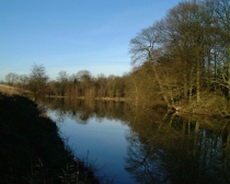
Times: Daily: Dawn 'til dusk For more information see; Rivers and streams Hartshorne village is surrounded on the East, North and South by hills. The highest is to the East being over 600 feet above sea level. There are a number of springs that start in these hills and flow out towards the West. One of the main streams rises from springs below Several Wood Farm and flows down through woods.
The Mill on Ticknall Road was built in the 18th century to manufacture steel screws and is referred to as The Screw Mill. The water left the Mill and ran down the valley running parallel to Repton Road down to Brook Street and passes near to the Old Manor. This section was called Repton Brook but is almost a small river due to other feeder brooks and streams joining it. It then runs into ponds at Nether Hall. These ponds fed a corn mill that had it's origins in the 1600's and was lastly called Glover's Mill after one of the Millers who ran it. Some time in the 1940's it's runs were demolished but some of the walls can still be seen. One other important feeder stream rises in the springs against the very old Manor Farm called Shorthazels Farm. This flows on the South side of the valley until it joins Repton Brook at Nether Hall. This, in Medieval times, was dammed at a number of places to create small water meadows and fish ponds. All the streams are very clean and fish are found in all parts, even water cress in a few places. Below Glover's Mill, Repton Brook flows past Chevins Farm set in a small deep valley and just past Chevins farm an old stone bridge crosses the brook to give access to the Repton Road. Just below it was another mill called Bugley Hole Mill. This was a leather making mill and the machines it contained flailed and treated animal hides. Only faint traces of this mill can be discerned. The brook then flows on past Noath's Ark Cottage and in the 1800's, into another large pond that fed the next mill called Bretby Mill that was used to grind flour. About half a mile down stream from Bretby Mill, there was another mill near to the entrance to the old road to Bretby village. This mill was fed by water held in a pond in Watery Road which is now the present road to Bretby. Repton Brook then flows into Crewes Ponds at Repton Cross. These were a source of drinking water for Repton. It then flows into Repton village where another flour mill was situated just past the New Inn. Signs of old stone work and a mill race can still be discerned. The brook then flows past Repton College and into the old Trent water course. The course of the present Trent is about half a mile further on. The brook rising in Several Woods measured to the old Trent is about 3 miles in length and as you can see, was a valuable asset to the area.
(Page Updated 26/05/09) |
||
|
The contents of this site are copyright © by Hartshorne Parish Council 2020. All rights reserved. |
 It
flows into 2 large ponds created to hold the water and then to feed
the water mill built on Ticknall Road. These 2 ponds were called
the Limehouse Dams. The water from one of the ponds was treated
with Lime and piped to a small waterworks on Manchester Lane, just
above Slack Lane.
